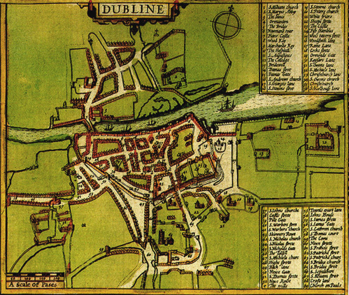
Speed's map
John Speed’s map of Dublin dates back to 1610. The map depicts, cartographically, the city walls and towers of Dublin. The image shows a beautiful illustration of what the medieval city would’ve looked like at the start of the modern era. The image from Speed’s map is of a walled town south of the Liffey with a vast suburban growth, focusing around the monastic houses. Speed however does not give any clear sign of the harbour but perhaps Merchant’s Quay fulfilled this function.
A noted feature of Speed’s map is the bridge that extends across the Liffey. One of the primary concerns of any colonial society is to have good communications and safety, the Anglo-Normans rebuilt the old bridge in stone. The bridge was the predecessor of the one shown on Speed’s Map
A noted feature of Speed’s map is the bridge that extends across the Liffey. One of the primary concerns of any colonial society is to have good communications and safety, the Anglo-Normans rebuilt the old bridge in stone. The bridge was the predecessor of the one shown on Speed’s Map